Mount Cilo Resko (Uludoruk) – Highest Peak Of The Cilo Sat Mountains
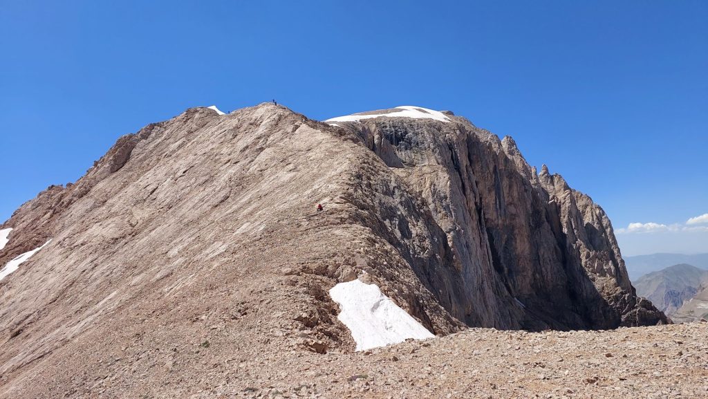
Mount Cilo Resko (Uludoruk) is located southeast of Lake Van, is the peak of the easternmost extension of the Southeast Taurus mountain range. Cilo Mountain is located at the southeast end of the Taurus mountain range, after Amanos Mountain, Ergani Mountain, Malatya and Bitlis Mountains respectively. Cilo Mountain, a tectonic mountain, is the second highest mountain in Turkey. Cilo Mountain is located between the Great Zap and Avarobashin streams.
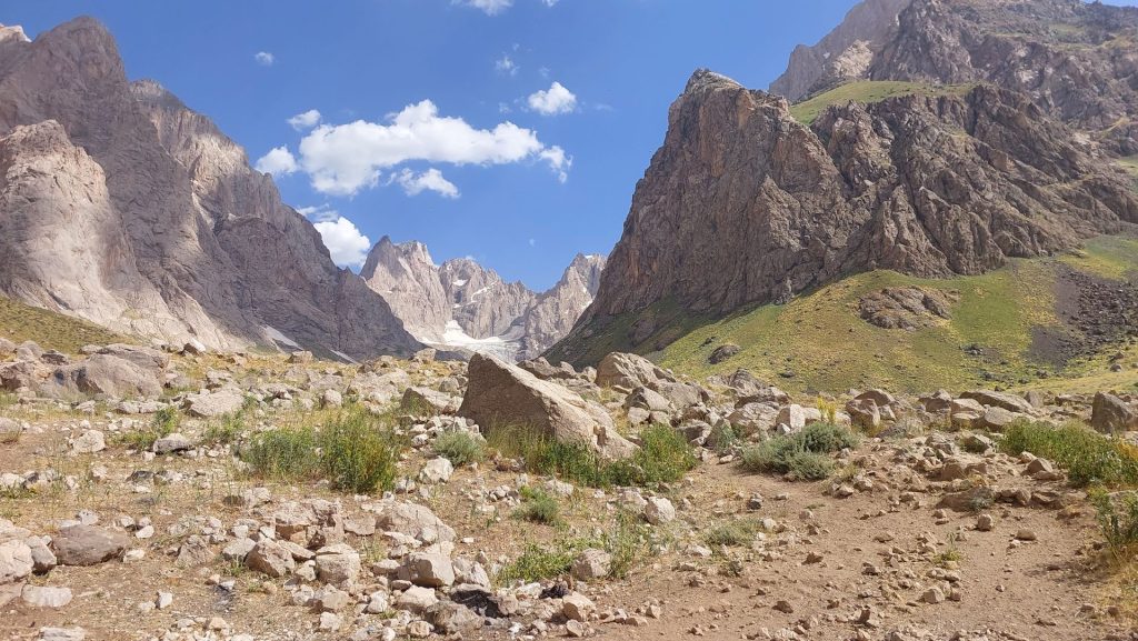
It is likened to the Alps because of its steep slopes, glacial lakes, continuous snow on its summit and large glacial masses. There are about 10 glaciers at 3000 meters and above Cilo Mountain. Some of these glaciers are several kilometers long. The width of the glaciers is between 350 and 820 meters. The thickness of the glaciers on the mountain varies between 20 meters and 100 meters in some places. The color of the glaciers varies from light blue to green.
The climatic conditions in Cilo Mountain are harsh and very rainy. Snowfalls that start in October continue uninterruptedly until June. The southern and northern slopes of the mountain have vegetation. Most of the other slopes do not have vegetation. Among the forest ruins on Cilo Mountain, oak trees are the most common. The animal population in the mountain consists of mountain goats, brown bears, raptors and wolves. As Cilo Mountain is not suitable for agriculture, except for some valleys, very few places have been populated.
Mount Cilo Resko Altitude
The altitude of Cilo Mountain is 4135 meters. Cilo Mountain is the second highest mountain in Turkey after Mount Ararat. Cilo Mountain has five important high peaks. These; Uludoruk Peak (4135m), Suppa Durek Peak (4060m), Kosedireği Mountain (3700m), Kisara Mountain (3500m), Maunseli Sivrisi (3850m) and Gelyona Hill (3650m).
Where is Cilo Mountain?
Cilo Mountain is located in the Southeastern Anatolia region of Turkey, within the borders of Yüksekova district of Hakkari province.
How to Get to Cilo Mountains?
If you prefer airlines; You can choose Hakkari Yüksekova Airport to reach the region. However, since there are not very frequent flights to that region, attention should be paid to flight dates or Van Airport, which is close to the region, may be preferred. You can reach the city center by shuttles from the airport. You can reach Yazıcılar Village by taxi or by renting a car from the city center. You can reach Cilo Mountain by walking from Yazıcılar Village.
If you prefer highways; You can reach the city center by busses going to Hakkari city or by your personal vehicle. Then you can go to Yazıcılar Village and reach Cilo Mountain with a similar route.
Is Cilo Mountain Volcanic?
The highest peak of the region, Cilo Mountain, which is also the highest mountain, was formed from calcareous and volcanic rocks. The volcanic rocks in the structure of the mountain are proof that it is a volcanic formation.
How was Mount Cilo Formed?
The basement mass of Cilo Mountain is formed by crystalline schists in the north and center, and mostly Cretaceous-Eocene limestones in the south and east. The southwest of the mountain is covered with cemented conglomerates and red sandstones.
Paleozoic folded-folded beds and crystalline schists form the basis of Cilo Mountain. In some parts, there are Cretaceous-tertiary formations and Mesozoic-tertiary formations.
The present shape of Cilo Mountain has been formed by tectonic movements and erosions. Thanks to these tectonic movements and erosions, flat plateaus and tertiary floors were formed in the region. The Yüksekova depression area of Cilo Mountain and the Great Zap scour and discharge areas were exposed.
Are There Glaciers in the Cilo Mountains?
Cilo Mountain has a glacier. There are glacial zones in three parts of the Taurus mountain range in the southeast. One of them is on Cilo Mountain. There are five separate glaciers on Cilo Mountain. These are the names of Reşko Glacier, Suppadurek Glacier, Kosedireği Glacier, Izbırak Glacier, Çiçek Vadisi Glacier.
The Mia Hvara (Heaven-Hell) Valley glaciers, which form a line just east of the Suppa Durek Glacier, are similar to the development of the Erinç Glacier. It is stated that the lower limit of the Mia Hvara glacier in the late 1930s was at 2550 meters.
How Old Are the Cilo Mountain Glaciers?
The glaciers on Mount Cilo are estimated to be about 20 thousand years old.
Is Cilo Mountain Folding Mountain?
All of the Southeast Taurus mountain ranges are fold mountains. Cilo Mountain is also a fold mountain.
Cilo Mountain, located in the Alpine-Himalayan Fold System; It emerged as a result of the movement of the Arabian, Anatolian and Eurasian plates. This situation has made Cilo Mountain, which forms the eastern end of the Southeast Taurus Mountains, rugged.
Mount Cilo Resko Climbing
Cilo Mountain has many peaks over 3000 meters. For this reason, it has many areas where they can freely climb and explore for those who are interested in nature sports.
Cilo Mountain is a place where those who go can experience the four seasons even though it has harsh weather conditions. Known as Turkey’s Alps, the mountain has many natural beauties, but it has a challenging course. Due to the climatic conditions, the winter months are quite cold. The air temperature can reach -30 degrees and it has dangers such as avalanche. For this reason, those who plan to climb during the winter months should be prepared.
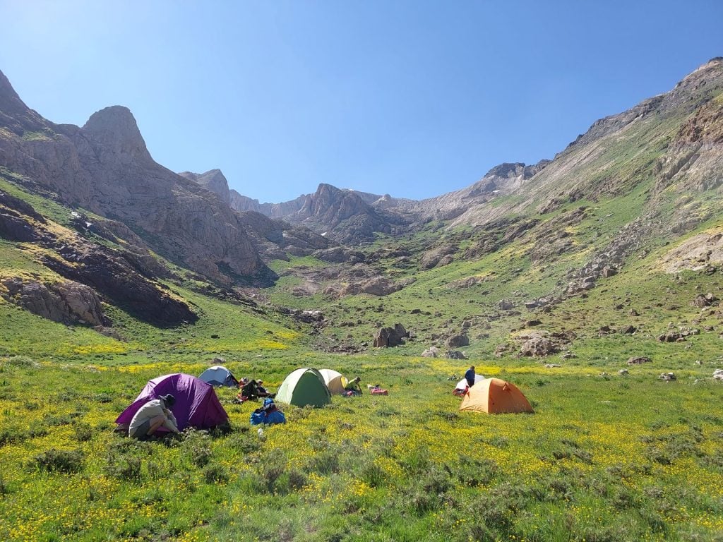
The most classical route is preferred by mountaineers. The classical route takes place via Yüksekova (Gever). Mountaineers using the classical route reach Serpil Plateau by going about 75 km on the Gever road. Then they advance to Horkadim Plateau. Later, they take a break by setting up camp on the plateau for one night. The climb, which starts early the next morning, is completed by reaching the summit in about 6 hours. The conditions of the mountain may vary as it is harsh. Climbers should carry technical equipment such as picks and crampons with them.
Mount Cilo Resko Camping
Those who want to camp on Cilo Mountain can camp near the Cilo Glacier Lakes or on the plateaus in the region. As we mentioned before; Cilo Mountain is dominated by harsh weather conditions, so those who want to camp should make the necessary preparations and go.
You can follow the current weather conditions for Mount Cilo Resko this site.
The mountain of the mountains, Mount Ararat may also interest you. Please click to read.

