Highest Mountains in India
India, a land of vast cultural heritage and dramatic landscapes, is home to some of the highest mountains in the world. The Indian Himalayas dominate the northern frontier, showcasing majestic peaks that challenge climbers and mesmerize travelers. The crown jewel is Kangchenjunga, the third-highest mountain globally, revered as sacred by local communities. Following it are formidable giants like Nanda Devi, Kamet, and Saltoro Kangri—each with distinct geographic, spiritual, and historical significance. From the glaciated ridges of Saser Kangri in Ladakh to the mythically charged Chaukhamba in Uttarakhand, these peaks represent more than just elevation; they are stories carved into stone and snow. Highest Mountains in India
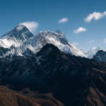
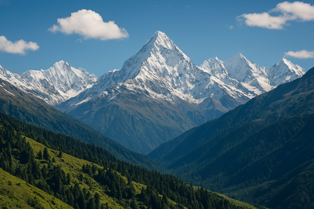
Mount Kangchenjunga (8,586 m) The Highest Peak in India
Kangchenjunga, at 8,586 meters, is the highest mountain in India and the third-highest in the world. Located on the border between Sikkim and Nepal, the massif consists of five distinct peaks and derives its name from a Tibetan phrase meaning “The Five Treasures of Snow.” While the main summit lies within Nepal, the Indian side offers significant climbing access and base camp routes. The first successful ascent was made in 1955 by a British expedition. Kangchenjunga is considered a technically challenging mountain due to its steep glaciers, frequent avalanches, and unpredictable weather. Climbing routes from base camp typically include narrow ridges, crevassed glaciers, and high avalanche-risk zones. Today, expeditions to the summit are limited, and many climbers stop a few meters short of the peak out of respect for its sacred status in local traditions. Reaching Kangchenjunga requires advanced high-altitude experience, thorough acclimatization, and robust logistical planning. Click for detail
Mount Nanda Devi (7,816 m) Highest Peak Within National Borders
Nanda Devi, with an elevation of 7,816 meters, is the highest mountain located entirely within India. It lies in the Garhwal region of Uttarakhand and is part of the Greater Himalayas. The mountain is central to the Nanda Devi Biosphere Reserve, a protected area recognized as a UNESCO World Heritage Site since 1988. Due to environmental concerns, access to the inner sanctuary surrounding the mountain has been restricted since the 1980s, which has contributed to its ecological preservation. The peak was first climbed in 1936 by a British-American expedition. Nanda Devi is known for its steep faces, narrow ridgelines, and difficult weather conditions. It requires advanced mountaineering skills, especially due to the remoteness and the complexity of its terrain. While direct climbing is currently restricted, the mountain remains a significant geographic and topographic landmark within the Indian Himalayas, often studied for its biodiversity and high-altitude ecosystem. Click for detail
Mount Kamet (7,756 m): The Third Highest Peak in India
Kamet, standing at 7,756 meters, is the third-highest mountain in India and is located in the Garhwal region of Uttarakhand, near the border with Tibet. It belongs to the Zaskar subrange of the Himalayas and holds a notable place in Indian mountaineering history. The first successful ascent was made by a British team in 1931, making Kamet one of the first peaks over 7,500 meters to be climbed. The mountain has a pyramid-shaped profile and features broad glaciers and demanding high-altitude conditions, offering a technically challenging ascent. The standard route typically approaches via the East Kamet Glacier and involves navigating snowfields, crevasses, and steep ice slopes. Weather conditions are highly unpredictable, adding further complexity to the climb. Its remote location also presents logistical difficulties. Due to these characteristics, Kamet is considered a serious objective suited for experienced mountaineers with high-altitude expedition background.click for detail
Mount Saltoro Kangri (7,742 m): A High and Restricted Peak in the Karakoram
Saltoro Kangri, with an elevation of 7,742 meters, is the highest peak of the Saltoro Range, a subrange of the Karakoram mountains located in the contested Siachen region of Jammu and Kashmir. The mountain is situated near the Line of Control between India and Pakistan, which makes civilian access nearly impossible. First ascended in 1962 by an Indian Army expedition, Saltoro Kangri remains one of the least visited high peaks due to military restrictions and geopolitical sensitivity. The mountain features steep glaciated faces, exposed ridges, and complex weather patterns, making it technically demanding. The approach routes involve navigating through the Siachen Glacier, which is known for its harsh environmental conditions and logistical challenges. Due to limited climbing history and restricted entry, detailed route data is scarce. Saltoro Kangri stands as both a significant topographical feature and a symbol of strategic control in one of the most militarized high-altitude zones on Earth. click for detail
Mount Saser Kangri I (7,672 m): A Technical Peak in the Eastern Karakoram
Saser Kangri I, reaching an altitude of 7,672 meters, is the highest peak in the Saser Muztagh subrange of the eastern Karakoram, located in the union territory of Ladakh, India. The mountain lies northeast of the Nubra Valley and is one of India’s most technically challenging and remote high-altitude summits. The first successful ascent was made in 1973 by an Indian Army team in collaboration with the Indian Mountaineering Foundation. Saser Kangri I is known for its steep glaciated faces, frequent rockfall zones, and unpredictable weather, making it suitable only for experienced mountaineers. Access to the mountain requires extensive planning due to its isolation and lack of nearby infrastructure. The approach typically involves glacier travel and crevassed terrain, increasing the complexity of expeditions. Despite not being closed to climbers, the mountain sees very few attempts each year. It remains an ideal objective for high-altitude climbers looking for technical difficulty and solitude.Click for detail
Mamostong Kangri (7,516 m) : A Remote and Glaciated Summit in Northern Ladakh
Mamostong Kangri, at an elevation of 7,516 meters, is the highest peak in the Rimo Muztagh subrange of the Karakoram and one of the most remote and less-explored mountains in India. Located in the northernmost part of Ladakh near the disputed regions close to the Siachen Glacier, the peak is rarely visited due to its challenging access and geopolitical sensitivity. The mountain was first successfully climbed in 1984 by an Indo-Japanese expedition. Its terrain includes steep snow slopes, heavily glaciated approaches, and high-altitude ridgelines, demanding a high level of technical expertise. Weather conditions in the area are often harsh and unstable, and climbers must contend with long approach marches and limited rescue support. Due to its location near restricted zones, permits are difficult to obtain, and only a few expeditions have attempted the summit. Mamostong Kangri remains one of India’s most elusive and technically demanding high-altitude objectives.
Mount Rimo I (7,385 m) A Remote High-Altitude Peak in the Karakoram
Rimo I, with a height of 7,385 meters, is the highest peak in the Rimo group of the Karakoram Range, located in the remote northeastern part of Ladakh, India. The mountain lies near the eastern flank of the Siachen Glacier, in a geopolitically sensitive area close to the Line of Actual Control. The first successful ascent was made in 1988 by an Indo-British expedition led by Harish Kapadia. Due to its isolated location and proximity to restricted military zones, the mountain remains one of the least climbed high-altitude peaks in India. Rimo I features sharp ridgelines, glaciated approaches, and technically complex terrain, requiring advanced mountaineering skills and thorough acclimatization. The approach involves long treks across crevassed glaciers and minimal logistical support. Limited access, harsh conditions, and lack of infrastructure make Rimo I a formidable challenge. It remains a rarely attempted but highly respected objective among elite Himalayan climbers.
Mount Hardeol (7,151 m) : A Prominent Peak in the Kumaon Himalayas
Hardeol, standing at 7,151 meters, is one of the major peaks of the Kumaon Himalayas, located in the Pithoragarh district of Uttarakhand, India. It is part of the northeast wall of the famed Nanda Devi Sanctuary and lies near the Milam Glacier, one of the key glacial systems in the region. Hardeol was first climbed in 1978 by a team from the Indo-Tibetan Border Police (ITBP). The mountain features steep ridges, corniced summits, and heavily glaciated approaches, making it technically challenging. The weather in the region is highly variable, with strong winds and heavy snowfall during most of the year. Access to the base of the mountain requires multi-day treks through remote valleys, with limited logistical support. While not as frequently attempted as some other peaks in the region, Hardeol holds significant prominence and is often studied in the context of regional glaciology and high-altitude mountaineering.
Mount Trisul I (7,120 m) :A Historic Peak in the Garhwal Himalayas
Trisul I, with an elevation of 7,120 meters, is the highest of the three peaks in the Trisul massif located in the Kumaon region of Uttarakhand, India. It is part of the Nanda Devi group and lies southwest of the Nanda Devi Sanctuary. Trisul I holds historical significance as it was the first mountain over 7,000 meters to be climbed, achieved in 1907 by a British team led by T.G. Longstaff. The mountain has a distinct triangular profile and features steep snow faces, ridgelines, and complex glaciated terrain. Its standard approach involves trekking through the Ronti Saddle and ascending via the northeast ridge. Despite its early ascent history, Trisul I still presents considerable challenges due to rapidly changing weather and avalanche-prone sections. The peak remains a popular but demanding target for experienced mountaineers and is frequently used as a preparatory climb for higher Himalayan objectives.
Mount Chaukhamba I (7,138 m) : The Dominant Peak of the Gangotri Region
Chaukhamba I, reaching an elevation of 7,138 meters, is the highest and most prominent peak in the Chaukhamba massif, which consists of four summits aligned from northwest to southeast. It is located in the Garhwal Himalayas of Uttarakhand, India, and towers over the Gangotri Glacier region. The mountain is considered a key landmark in the Gangotri area and forms the eastern boundary of the Gangotri Group. The first successful ascent was achieved in 1952 by a French expedition led by Lucien George. The climb involves traversing heavily glaciated terrain and steep ice slopes, particularly on the northwest face. The standard route begins from the Gangotri Valley, requiring a multi-day approach trek and high-altitude acclimatization. Harsh weather, crevasses, and avalanche-prone sections add to the difficulty. Though not frequently climbed, Chaukhamba I is valued for both its strategic prominence and its role in regional glaciological studies.
SUSTAINABLE DEVELOPMENT IN THE INDIAN HIMALAYAN REGION